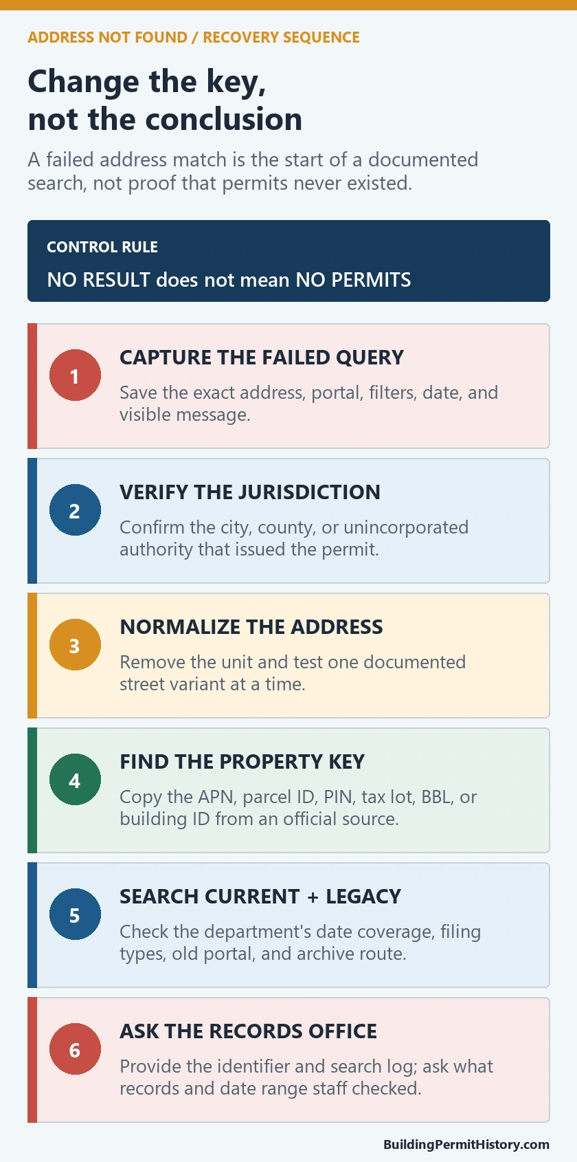
When an address is not found in a permit system, do not treat the blank as a no-permit result. First confirm the issuing jurisdiction, then normalize the address, switch to parcel or project identifiers, and search both current and legacy systems. Seattle demonstrates this recovery path through its Research a Project page and Permit and Site History map.
Official route checked August 26, 2026: Seattle Department of Construction and Inspections; Recheck Seattle’s current and historical systems, development-site identity, record era, and microfilm route before interpreting a blank.
The goal is not to force one search box to return something. It is to identify which official system owns the property, record era, and document type, while preserving every failed input and the evidence that eventually resolves the match.
Confirm the address belongs to the searched authority
A mailing city or postal code can cross a permitting boundary. Verify whether the parcel lies in Seattle and whether Seattle’s construction department issued the record. If the work involved county, state, fire, utility, or another special permit, note that separate owner before changing the street text.
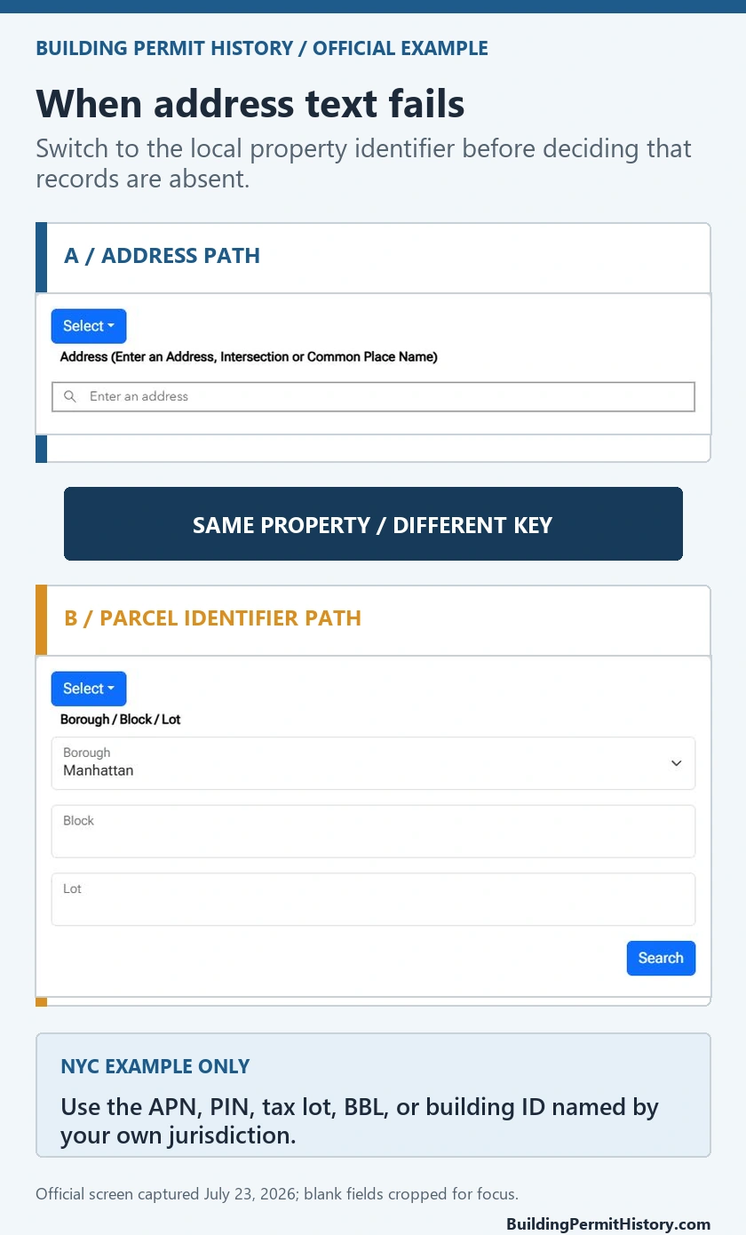
Use the city-or-county permit guide to record the jurisdiction decision. Keep the official parcel or property identity used to make it. A correct address in the wrong government system will still produce a misleading blank.
Normalize the address without losing the original
Create variants systematically: remove the unit, separate the directional, expand or shorten the suffix, check former numbering, and try a range address when the site contains several numbers. Save the original and every variation with its result.
Do not begin by changing several fields at once. Test one variation so the successful match can be explained. If the portal suggests an address, copy the displayed form and verify its parcel or development-site context before accepting it.
Use the address permit lookup guide to retain the selected address, parcel, and issuing authority as separate identifiers.
Search Seattle’s current project route for 2005-forward activity
The Seattle Research a Project, Permit, or Property page directs users to current project and permit information by address or project number and describes activity from 2005 to the present. It can expose project, permit, inspection, and related status information.
Search the normalized address, then any known project or permit number. Record the development site, project number, permit number, type, description, status, inspection status, and linked documents. If the address is absent but a project number works, preserve the project’s displayed address and compare it with the intended property.
A current-system blank can be an era clue. If the likely work predates 2005, move to the history route rather than concluding the property had no permits.
Use Permit and Site History to recover the development site
Open the Seattle Permit and Site History map and search or navigate to the property. This route can connect address and map geometry with a development-site identity, record numbers, plans, and historical materials.
Select the property polygon or site, not merely the search marker. Copy the site or record identifiers and examine nearby or parent sites when a building spans parcels or address ranges. A remodel may be filed under the main building address even when the searched unit or entrance is different.
Keep results from the current project route and history map in separate columns. Join them only through verified site, property, or record identifiers.
Recover with project, parcel, and legacy clues
Use a recovery ladder:
- Base address without unit
- Official displayed address variant
- Parcel or development-site identity
- Project or permit number from a notice, plan, seller, or contractor
- Former address or building number
- Map navigation and neighboring-site context
- Historical record or microfilm request
The permit number lookup guide can help preserve prefixes, year codes, and parent-child relationships. Do not strip punctuation from a number unless the Seattle system instructs it.
If two identifiers return different properties, stop. Save both and ask the department which site record corresponds to the legal property.
Move older plans and records to the historical request path
Seattle’s research page identifies a historical microfilm and plan-request route for records not available through the current online layer. Prepare the project address, permit number when known, record type, and approximate year. Name the plan, permit card, inspection record, or other document needed.
An expected plan missing online is not evidence that no approved plan exists. Some documents have access or reproduction procedures, and older records can be indexed differently. Record the request date, response, archive reference, and any new identifier supplied.
Use the old permit lookup guide to keep historical and current searches from being mixed.
Build a failure log that supports the next step
For every attempt, retain the system name, exact input, time, result count, selected property, and reason it did not resolve the question. Classify the failure as wrong jurisdiction, address rejected, multiple candidates, no current record, likely legacy record, identifier conflict, or document unavailable.
This log prevents repeated random searches. It also gives the records office enough detail to understand what has already been checked. A statement such as nothing found is weak; a dated list of current and historical systems, identifiers, and outputs is actionable.
Send a targeted Seattle request
Provide the full address, parcel or development-site identity, all variants, project or permit numbers, approximate work date, record type, and failed-search log. Ask which official site or archive record represents the property and how to obtain the named permit, plan, inspection, or completion document.
The final result may be a corrected address, a project number, a legacy reel, a referral, or a documented no-responsive-record search. This packet is not a substitute for a current site inspection or agency determination. The successful recovery is a reproducible record path, not a broad claim that the property is permitted or unpermitted.