Building permit data is limited by jurisdiction, system purpose, date coverage, record type, property identity, and update rules. A no-result search can mean the wrong authority, an unsupported era, an address mismatch, a separate trade system, a closed record removed from a status portal, or a record that was never digitized. Before relying on any result, write a coverage profile for the exact source.
Official route checked August 26, 2026: City of Chicago Department of Buildings. Recheck jurisdiction, system purpose, date span, removal rules, refresh timing and recovery layer for the exact source used.
Define the question the data must answer
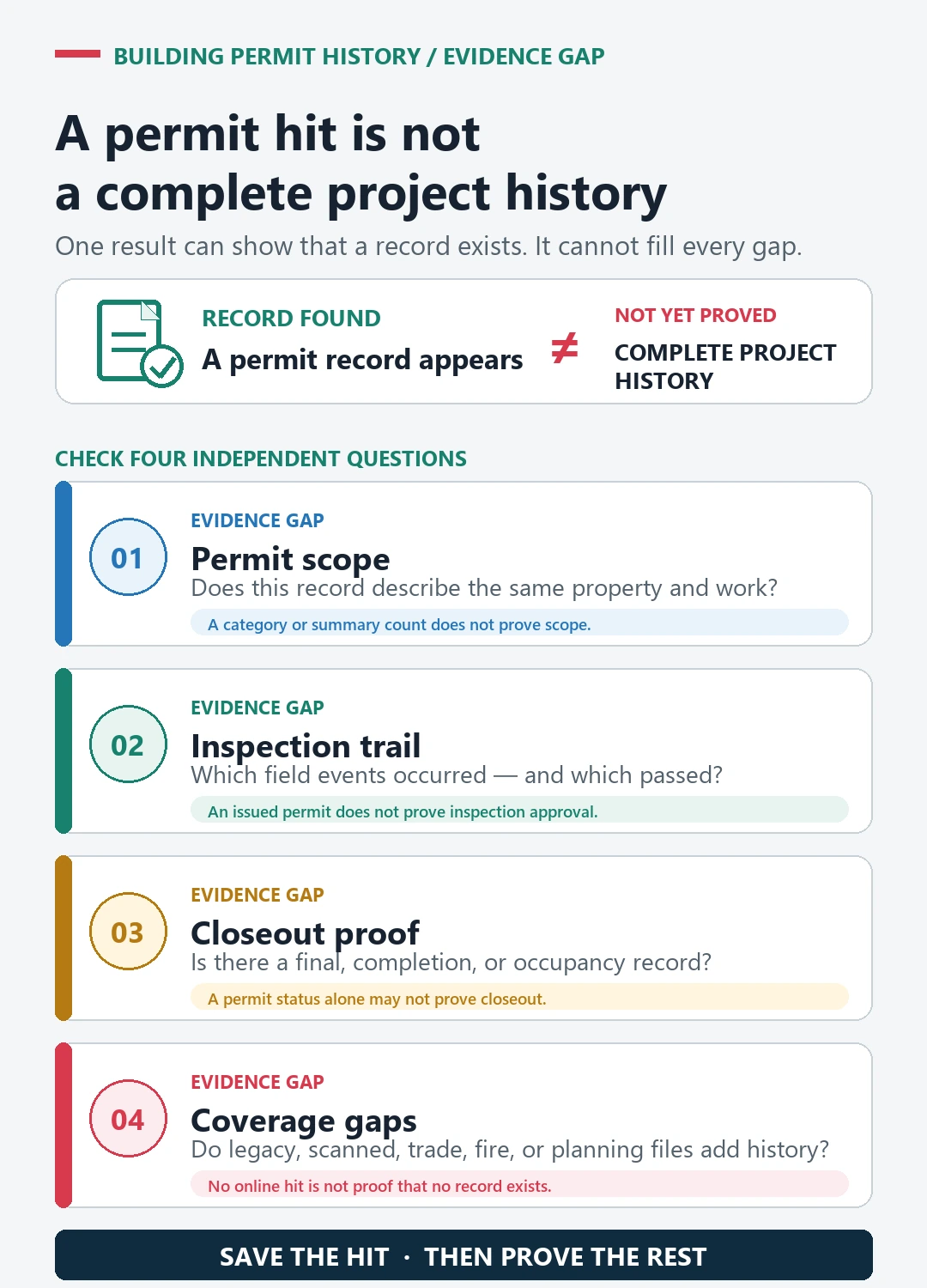
Different questions require different evidence. An application database can show review activity. An issued-permit dataset can show permits that reached issuance. An inspection system can show recorded field events. A scanned property file may preserve older documents. None of those layers necessarily describes the entire legal and physical history of a building.
State the intended decision first. Are you trying to identify a remodel scope, find an open application, verify a final inspection, locate approved plans, or learn whether older work appears in the archive? Then identify the minimum fields needed to answer it. This prevents a convenient address result from being stretched beyond its purpose.
Check the government boundary before the database
Permit authority follows local jurisdiction, not a national address directory. A mailing city can differ from the incorporated city, county, township, or special authority that issued the record. Boundaries also change. Annexation or consolidation can leave older files with a predecessor agency.
Confirm the parcel location and the authority responsible at the approximate work date. If the property lies near a boundary, keep evidence of the jurisdiction determination. The city versus county permit records guide provides a structured way to test that branch. Searching the wrong official portal still produces an official no-hit, but the result does not apply to the property’s actual custodian.
Identify what the system was designed to display
Chicago illustrates why system purpose matters. The City’s Building Permit Application Status help page says the service is designed for applicants and authorized representatives to monitor applications during review. Public address searches show more limited information, and the service covers applications started during the last 36 months. It also distinguishes review activities, holds, corrections, and issue dates.
The City’s separate Building Permits dataset is an issued-permit data product. Its rows and fields serve a different purpose from a recent application monitor. A person seeking an older issued record should not stop after the review-status tool returns nothing. Conversely, a dataset row does not automatically supply the full correction history or approved plan set.
For every source, record its owner, stated purpose, included record types, excluded types, public-versus-authenticated differences, and whether it is a search interface, operational workflow, downloadable dataset, document repository, or archive index.
Record time, deletion, and refresh boundaries
Coverage dates are not mere footnotes. Toronto’s permit application and inspection status page says its status site contains active permits ten years old or less and permits closed or cancelled for no longer than one month. It also says information is updated as of the previous business day.
Those rules explain two common false conclusions. A recently closed result can disappear from the current-status view, and a change made today may not appear immediately. Save the checked date and the page’s coverage statement with the result. When researching a historic project, identify the archive or closed-permit layer instead of repeatedly querying a current operational screen.
Dates inside the record also need labels. Application, issue, inspection, completion, closure, cancellation, data refresh, scan, and upload dates describe different events. Sorting all of them as if they were construction dates can create a false timeline.
Treat address and relationship gaps as separate problems
A database may normalize directions, suffixes, range addresses, units, parcel numbers, or former street names differently. One development site can contain several tax parcels, while one parcel can host several addresses. Search the authority’s recognized property identity and save each variation tried.
Related records may also live in separate tables or systems. Building, plumbing, electrical, mechanical, fire, planning, zoning, code enforcement, and occupancy files can use different identifiers. A parent permit may not list every child trade permit. An address query may cap results or favor recent rows. Use permit numbers, application numbers, parcel identifiers, shared project descriptions, and dates to build explicit joins. The permit number lookup guide explains how to preserve those joins.
Translate status fields only within their source
Labels such as active, issued, approved, complete, final, expired, closed, cancelled, or void can have source-specific meanings. Read the authority’s glossary or field definition before interpreting them. An approved review can precede permit issuance. An issued permit can remain under inspection. A passed inspection can be one stage rather than the final event.
Copy the exact status, field name, and access date. Then state the limited inference. For example, a row may support that a permit was issued on a certain date; it does not by itself prove every inspection passed or the building’s present condition. Use the final inspection status check when closure affects the decision.
Build a seven-part coverage profile
Before declaring a search complete, write one line for each dimension:
- Authority: the government unit and historical custodian.
- Purpose: application tracking, issued permits, inspections, documents, or archive discovery.
- Record families: building, trades, enforcement, occupancy, and related layers included.
- Time: earliest stated date, retention or removal rule, and any era break.
- Identity: supported address, parcel, unit, map, and identifier inputs.
- Update: refresh date, lag, corrections, and public display limits.
- Recovery: historical search, records request, microfilm, plan room, or successor system.
If one dimension is unknown, mark it unknown. Do not convert missing documentation into a claim of complete coverage.
Recover information beyond the visible dataset
When a result is missing or insufficient, move deliberately to the next record layer. Seattle’s official Research a Project page routes users among current portal information, permit and property records, historic microfilm, plans, and open data. That kind of agency-authored route is more reliable than guessing from a third-party index.
Prepare a request with the official address, parcel or development-site identifier, former address, approximate dates, permit number fragments, and exact record families. Include the systems already searched and their stated coverage. Ask where the authority keeps the relevant era, not whether the absence establishes that no permit existed.
State what the dataset supports and what it cannot
A good conclusion has two parts. First, identify the positive evidence: which authority, source, property identifier, permit number, scope, dates, statuses, and documents were retrieved. Second, name the remaining limits: an older era not online, a missing trade layer, an ambiguous address, plans not reviewed, or no final field.
This method turns data limitations into an actionable research map. It also keeps a user from treating an official but partial system as a comprehensive legal opinion, safety inspection, title report, or certification of the building today.